The entire afternoon on Wednesday was filled with talks directly related to the type of problems I look at and the type of modeling I do - a pretty sharp contrast with Tuesday! The morning, however, was fortunately open for such things as practicing my talk one more time for my adviser, and for meeting with SCEC's education and outreach team about "Faults of Calfornia."
The practice run went smoothly. I presented preliminary results of the same work at the SCEC meeting in September (and then I had to do all the models over because we switched finite element codes), and I did a couple of practices of the talk at UCR over the past few weeks. My biggest concern was timing, since my first practice clocked in at 13.5 minutes without questions, but my second practice went at Mach 1, taking only 9 minutes. Yesterday's practice was a clean 12 minutes, and I haven't had any more coffee than usual this morning, so my timing should remain spot-on.
The meeting with SCEC was also productive. Our main goal right now, since the illustrations on "Faults of California" are all done, is to figure out the best way to get it into schools. We don't want to just hand it to teachers without any structure, since that's not the best way to integrate into anyone's lesson plans. We came up with a few ideas; my holiday reading is likely going to involve reading some of the California Education Standards, and it looks like there will be some drives to USC in early 2010.
As some of you reading this surely already know (since I assume at least some of you were there), there was a planned lunch for geobloggers at AGU yesterday afternoon. I'd say there were about 25 of us in all. The first half was more informal conversation - it was nice, as with the Tweetup on Monday, to put faces to names and blogs. (And, in the case of those of you I'd met before, it was great to see you all again!) The second half of the lunch involved everyone getting up and introducing themselves and their blogs, then sharing their particular thoughts on the state of the geoblogosphere. I'll repeat a thought I had at the time: I think it's wonderful that so many of us started blogging because we just plain like discussing our field and research, and that this network of blogs has turned into a real and more formal way to exchange information and dialogue in the sciences.
I had to duck out of the blogger lunch a bit early because I didn't want to miss the set of talks on earthquake source modeling. Occasionally, I have a moment of worry that someone will scoop the particular things I want to research/model - because there can't be that many people modeling fault dynamics, right? - but sessions like this make me realize that I'm being dumb for worrying so much. There's a huge diversity of topics, methods, specific problems, and ways to interpret within the definition of "earthquake source modeling," and even in four hours of talks, there's still tons and tons more that hasn't been covered or done yet. One of the main themes in this session was the idea that multiple faults can be involved in a single earthquake. This has been known at least since the M7.3 Landers earthquake in 1992, which surface ruptured its way through parts of six faults, but many of yesterday's talks discussed the possibility of there being subsidiary faults in quakes not known to have involved more than one fault, or the possible contribution of smaller faults to a quake on a much larger one. With all these discussions, I feel like I've come into looking at the problem of fault geometries and interactions at just the right time, and that makes me all the more excited to keep on modeling things.
My talk is also a complex fault geometry talk, though in this case, I'm looking into geometrical effects on ground motion, rather than just on rupture behavior. It's this morning (Thursday, 17 December) at 11:05 AM in Moscone West room 2005. I hope to see some of you there!
Thursday, December 17, 2009
Wednesday, December 16, 2009
AGU 2009, Day Two
There are always a gajillion different things going on at AGU, to the point where it's overwhelming to consider all of it. When I considered the categories that are most likely to relate to my work (Seismology and Tectonophysics, also sometimes Union), Tuesday seemed to be the day that had the least subject matter related to my own work. That made it a logical day to catch up with people and discuss projects and research - not to mention, it was a good day to do my stint as the representative at the UCR booth in the exhibition hall.
The first thing I did was head over to the Southern California Earthquake Center booth to set up a time to discuss a project I've been working on with them. I know I've mentioned this project rather evasively thus far, and while I can't give lots and lots of details yet because it hasn't been released yet, I will say that it's an earthquake awareness comic book called "Faults of California." The illustrations were finished this summer, but we're working on a education module to go with it. We ended up deciding to meet about this on Wednesday, but I stuck around the booth to help set up. This involved a scene of several people jumping up and down while shaking a poster tube, trying to dislodge a bunch of plate tectonics educational posters. Brings new meaning to the idea of "ShakeOut"!
I did go to a late morning session on earthquake early warning systems. Most of them were variations on the theme of using P-wave amplitude to make a guess at eventual magnitude, though they all suggested different ways to implement this. One took the approach of tracking sudden motions by GPS and reporting them that way (though, from talking to people at UCR who work with GPS, I would think this would take a while to process?). Another aimed to estimate the direction and extent of the eventual rupture by looking at wave directivity. This one was particularly interesting to me in that I think it would benefit from some sort of prior including possible rupture paths for faults with complex geometry. I hadn't ever thought that the kind of models I do could help with early warning, but apparently they could! The early warning session also included a talk on the Quake-Catcher Network, which I've blogged about on here before. This network uses the accelerometers built into laptop computers as basic earthquake ground motion sensors, and sends the timing and shaking data to a central network for consideration. When I first installed the software in early 2008, QCN was still in alpha-test mode. It currently has expanded to over a thousand users across the globe. (And I'd encourage you all to check it out and add to the member count!)
I spent the entire afternoon at the UCR booth in the Academic Showcase part of the exhibit hall. Traffic was relatively slow to the booth (and it probably didn't help that we were between Yale and Virginia Tech), but there were a few prospective students who signed the mailing list. I also got a lot of questions more pertinent to the Environmental Sciences department (which is not the same as the Earth Sciences department at UCR), and a lot of inquiries about "Where is Riverside, anyway?" (when I answered that one, it was often followed by, "Wow, is it really hot?"). I assure you, visitors and questioners, that our department is worth another look. Being in the desert and 100+ degree heat does nothing to hinder the good work coming out of UCR.
Tuesday, December 15, 2009
AGU 2009, Day One
So! I'm going to attempt what, given my past history with regular updating, may seem like a futile effort. That is, I'm going to try and blog every day of this year's American Geophysical Union Fall Meeting (in San Francisco, as usual) separately. This is just as much a way to not gloss over things as it is a way to try and practice general better blogging habits. This meeting has already stressed the importance of blogs for communication, and the possibilities of using Twitter both for spreading and collecting information about various geological/enviromental/hazard/etc. events. I've certainly been tweeting a lot lately, but my blog is now saying, "Don't leave me for that biiiird!" And so, daily entries for the conference. Yes.
(I'll also be dumping a day-by-day of the class trip to Kīlauea in here soon - possibly later today, if the UCR booth in the exhibitor hall has low traffic.)
The very first talk of the very first Tectonophysics section yesterday was one I really wanted to go to. It involved the formation of the San Andreas Fault, with comparisons to the transform boundary in New Zealand. Alarm clock failure (in that, it did not go off) prevented me from attending, but I was able to get going quickly enough that I made it in to the middle of the second talk of the session (about a possible shift of the North American-Pacific plate boundary to the eastern side of the Sierra Nevada). The whole morning in the Tectonophysics group was devoted to continental transform boundaries, in fact. Most of these talks were focused on characterizing these boundaries, whether by classical mapping, looking at seismicity or paleoseismic data, or studying (very very shiny awesome) LiDAR images. There was a definite focus on geometry at several scales - map, or fault surface roughness, or shape of the damage zone. There was not, however, much talk of earthquake behavior on these systems, but thatʻs the divide between this group and the Seismology one, I suppose! I opted to listen to as many of the continental transform talks as I could, since my work is all about looking at rupture dynamics and ground motion on faults with geometrical complexities, and thereʻs a good chance that Iʻll be looking at the constraints on fault structure and geometry that researchers in the Tectonophysics group in constructing dynamic models sometime in the future.
(I was, however, slightly disappointed, that the Garlock talk basically led to the conclusion that "everyone still has completely different ideas of how much this thing is slipping." Ah well!)
After lunch (and after inflicting Hawaiʻi photos on a friend from Berkeley), I headed into the poster hall to get a look at as many more things about geometrically-complex strike-slip faults as I could. I got in some skimming before coming to a poster about segmentation and postseismic stress state in the Landers earthquake. I ended up getting into a great and detailed conversation with the poster-presenter, and before I knew it, it was time to go to another session.
The last session I went to was completely out of my area of more than scant knowledge, but at the same time, it was something that has interested me since I was ten years old. The session in question was a planetary science one, discussing this summerʻs Jupiter impact. The session was under embargo, so I wonʻt go into anything about what was actually said (other than the fact that Jupiter is apparently, quote, "insidious" about not showing features under certain filters), but it sent me back to that place of ten-year-old wonder when Shoemaker-Levy 9 slammed into Jupiter in 1994. That impact entirely captivated me, to the point where I was making an attempt to understand NASA press releases, contacting discoverers of the comet by email (seriously), and making my parents take me to a Smithsonian press conference about the impact. Iʻm not really sure I know much more about comets now than I did at the peak of my astronomy obsession, and Iʻm sure I was more timid about asking questions yesterday than I would have been in 1995, but I still thoroughly enjoyed hearing everything that the presenters had to share about this new impact.
The evening was occupied by a meetup of Geonerds On Twitter at 21st Amendment on 2nd Street. I had no idea what to expect in terms of attendance or formality of discussion, but there was a huge turnout and a very fun casual air about the whole thing. It was absolutely great to put faces to the names Iʻve been interacting with online for so long, and it was just as awesome to get to have incredibly unabashedly nerdy conversations with people that didnʻt end up getting bored with said unabashed nerdiness. Topics included the difference between astrophysics and planetary geology, when the best time to visit the Mojave is, how close we all live to various active faults, fuzzy animals, beer, and the usefulness of Twitter and blogs in conveying geogeekery across the internet and world. Iʻm hoping thereʻll be events like this one at future conferences! (Or, if thereʻs another one in San Francisco not during a conference, it gives me another excuse to come up here again...)
Thereʻs a luncheon for geobloggers on Wednesday. How many of you will be there?
Saturday, October 17, 2009
San Francisco, October 17th, 5:04 PM
I drove across the Bay Bridge this morning, as did many other people. Many other people did the same at that time of morning twenty years ago today as well. It was a normal drive to them; they had no idea that they wouldn't be able to drive back the way they came for their evening commute. True, I couldn't say for sure that I knew I'd be able to drive back that way this year, but with the events of twenty years ago on my mind, I think I was more aware of the possibility that it could happen again at some point in the future, near or far. I suspect that other drivers on the Bridge were thinking about it more than they might have on any other day as well.
I can't know for certain, but I suspect that this anniversary was far more on the mind of the City at large than the 1906 anniversary was, for reasons of time and experience. Loma Prieta was, after all, a smaller earthquake that didn't completely destroy the City, but it was, in the grand scheme of things, recent, and it simultaneously highlighted what an overall smaller quake can still do to a modern city, and how everyday people can be absolutely heroic in their attempts to save lives and stave off more damage. It is still a shared experience among many people here (and even those who weren't here at the time surely know people who were), rather than a historic commemoration at which the few remaining survivors are revered as living monuments. It is still very much a living memory, a community disaster.
And the City formally approached it in a way that reached into communities, rather than as a ceremony to only draw out the devoted. Specifically, street fairs with a theme of earthquake/disaster awareness and preparedness happened in four areas of the City (Mission, Marina, Bayview, and Sunset), to be followed up by more informal block parties. This did not strike me as the most intuitive way to commemorate a disaster in which 63 people died, but I still volunteered to help out. After spending the day in the Marina handing out emergency preparedness activity workbooks and painting little kids' faces, though, I think I got the idea. Earthquakes effect the whole community, and the community does need to discuss them to figure out how to best survive individually and as a group. Treating quakes like the boogeyman, like something only to be talked about in a Very Serious Environment, isn't going to promote open discussion. The fair environment, initially jarring though it was, seemed to be an effective casual space to discuss personal experiences (I heard snippets of so many people's stories of what they were doing when the quake hit - and a guy from channel 4 news seemed outright disappointed when I told him I wasn't here at the time and thus didn't have my own story, since he figured I would've had an interesting little kid perspective on it), as well as a place where people could start actively building their emergency kits from items at the various booths. The fair was not a celebration of the earthquake, but of the ability of people to withstand it and resultantly know even better what to do in the event of the next one.
The fair was followed up by a more solemn ceremony, with a set of speakers including the chief of the San Francisco Fire Department, the Marina District Supervisor, and Mayor Gavin Newsom. The theme was remembering those who had died and praising those who did so much to save lives. The ceremony also served as a dedication of a new monument to the victims, survivors, and emergency workers of Loma Prieta. The monument itself consists of the brass nozzle from the fireboat Phoenix, which saved the Marina District by pumping baywater through portable hydrants. It isn't installed yet, but was placed atop its eventual location for today's events. Both the printed program and the speeches expressed the hope that the Marina Earthquake Monument will become a sort of "21st century Lotta's Fountain," echoing the post-1906 gathering place. Yearly October 17th ceremonies seem to be the plan, though I do have to wonder how successful they'll be. The 1906 ceremony evolved from the Fountain being a central meeting place. The Phoenix's nozzle was certainly central in 1989, but the gathering of crowds wasn't. I do hope that the annual meetings take off, however, and that they continue to be an environment in which people can openly discuss what they'll do when the next one hits, as they did today.
Some other things about today's ceremony echoed the 1906 ceremony I attended in April. Everyone sang again, the same song "San Francisco" as has been a staple at Lotta's Fountain for so long. I don't think I was surprised that the same song was used, though I did find it interesting that the same thing was used to touch the living memory earthquake as to the largely historical one. There was also a definite push to get things said before the minute of the quake, so that it could be set aside from the rest of the ceremony. But where the minute of 5:12 AM on April 18th echoed back to 1906 with silence, 5:04 PM on October 17th called Loma Prieta with noise. Mayor Newsom activated a fire siren mounted on the stage, and all the fire trucks collected around the Marina Green blasted their own sirens back. The fireboat Guardian spouted three high plumes of water back over the Bay, a display that served well as a visual representation of the sound. Once the blasting faded out, a bell that tolls whenever a firefighter is injured or killed was rung in a pattern that was at once quieter than the previous barrage of sirens, but more striking against its background noise level. It was as if the sirens were screaming, "This was our earthquake! We were hit hard, but it couldn't take us down, and what did go down came back! We are stronger than this disaster!" and then the bell added, "We still can't let it happen that way again."
As I walked back to my car after cleaning up the fair area, I went past the intersection of Beach and Divisidero, where the Marina fire started and hit hardest. The post-1989 buildings there are all solid and bright and without sign of past disasters. Behind them, the sunset backlit puffs and shreds of grayish cloud with shades of orange and red. It was a beautiful sunset, but in that context, I couldn't help but think it looked rather like a fire, fortunately constrained to the sky rather than touching the buildings below, but still reminding of a tangible past and a potential future.
Friday, October 16, 2009
Geosong: Liz Pappademas' "Loma Prieta"
It's been a long time since I posted a geology-related song (even though my collection of them has been growing steadily), but I've been waiting for just the right moment to post this one. Seeing as tomorrow is the 20th anniversary of the M6.9 Loma Prieta earthquake, I think we've come upon the right time.
I found this song by typing "Loma Prieta" into the iTunes store, as I've had to get more and more specific (or obscure) to keep expanding my playlist. Two songs with the title popped up, and I downloaded both of them. This was the one I liked better, though; the other puts the quake into a relationships context, but this one seems like it must be describing an actual real experience.
I'd never heard of Liz Pappademas before, and I still don't know how well-known she is. Her website tells me that she was raised in San Francisco, but has moved around since and is currently a resident of Los Angeles. I think I could have gathered the first part just from the lyrics to the song. It opens with, "Loma Prieta, dark hill. Shook up the San Andreas to the heart of a little girl," and goes on to be an account of a very scary experience told through the eyes of a child who has some understanding of what's going on in a physical sense, but is having more trouble with the emotional side. She describes clinging to her mother in the doorway (nevermind that you shouldn't get in the doorway!), of school being canceled, of camping out in her parents' bedroom, of expecting aftershocks, and of feeling much older after the whole experience. There's also a stanza, a little more separated from what appears to be personal experience, that describes images of 1906 being recalled by the fires in 1989. I don't know how much a little kid would or wouldn't know about 1906 as a product of a San Francisco upbringing, but I do know the comparison is consistent with some of the news media about Loma Prieta. It's certainly a moving comparison in the context of the song.
In terms of the music, "Loma Prieta" is both simple and complex. It's simple in terms of its instrumentation - mostly just voice against a piano accompaniment consisting of elaboration upon broken chords, with a little bit of electronic stuff for color. The chord sequences are not, however, your typical I-IV-V-I of so many pop songs. I'd have to sit down and think about exactly where the chords go, but the specific progression is not the point - rather, it matters more that it takes a while to get to the resolution, and there are parts that don't get resolved. The melodic line is also very free, with phrases of unequal length and pacing. It also encompasses a wider range of pitches than many pop songs do; not lingering on a specific set of pitches adds to the somewhat freeform feeling of the song. In the way the melody is shaped (and perhaps also in the broken chord piano accompaniment), "Loma Prieta" seems to be toeing the line between pop song and art song.
I very much like this song, for its subject and for its music. I think that this free and sparse style of music fits the storytelling aspect of the lyrics, and I think that the lack of any attempt to paint the words with the music allows the severity of what the singer experienced to be come all the more stark and clear. The last verse also really gets me: "Loma Prieta, dark hill. Please stay dark, I pray, please stay still."
Please stay still. This is a very human thing to plead after disaster, but the plea is made to something that cannot and will not stop moving. That particular mountain may not be shaking all the time, but the forces underneath it keep grinding steadily away, and eventually, there will be another earthquake at Loma Prieta Peak. It's inevitable, and the music seems to know it, even if the lyrics pray for it to not be so - the final cadence never quite happens.
Liz Pappademas on Rhapsody. (You can listen to the song for free there.)
Wednesday, September 23, 2009
Southern California Earthquake Center meeting, 2009
I live! And not only do I live, but I've had an intensely busy and extremely productive August and September, with a combination of conferences, personal travel, research, and many many hours of work (and hours of sleep lost) on an outreach project called "Faults of California." I'll post more extensively about that project once it's at the point where I can actually show it to you, but for those of you who follow me on Twitter, this is related to all of the stuff I've been posting about "talking faults" and "comic books."
Anyway! Last week was the annual Southern California Earthquake Center meeting in Palm Springs. Last year's SCEC meeting was my very first scientific conference ever, and even though I went before I'd had any graduate level earth science classes, I still came out of it with tons of ideas for things I wanted to research. This year, now that I've been taking seminars and doing research all year, was even better. I had a much better overall understanding of posters and talks, but even more important, I was much better able to really converse with the people stopping by my poster or the people whose posters I visited, rather than merely explaining what I did, or merely listening to their own explanations. So, in addition to giving me yet another huge load of ideas I'd love to research/model, this year's SCEC meeting also served as a good marker for what a year of work can do. I'm certainly not thinking of myself as "that hack with a music degree" as much as I used to!
A hopefully-brief day-to-day rundown of the meeting:
Saturday, 12 September
Arrived in Palm Springs by 9:30 AM, for the beginning of a workshop on dynamic weakening mechanisms at 10 AM. The research presented in this workshop consisted primarily of laboratory experiments on various types of rock and fault gouge, most of which used a rotary shear device, though with different sets of stresses and different effects being observed. The particular focus seemed to be on assorted flash heating effects, and also the possibility of gels being created from fluid and silica on faults. There seemed to be a little frictional heating between the differing presenters, who sometimes disagreed on each other's experimental setups or interpretation of results, but even with the debate, it was enlightening to see some of the experimental work that goes into the friction laws and fault behavior equations that are coded into the modeling software I use on a regular basis. Toward the end of the day, I slipped out to hear a friend's talk in a workshop on transient detection; his talk was quite clear and well-delivered, though the other two before it were far too caught up in a type of math I haven't yet learned to make any sense to me.
Sunday, 13 September
The second annual SCEC student field trip was to San Gorgonio Pass. This area is particularly intriguing to me because it's a total mess of fault geometry, with curves, bends, branches, and stepovers, with transitions from strike-slip to thrust and back again. This is the kind of crazy complexity I'd love to model at some point, and getting to actually walk all over it and see contact points and evidence of the collision of the Mt. San Jacinto block with the San Bernardino Mountains brought the details of this unusual area far more into light than only reading about them would have. The field trip focused on features associated with these transitions in fault behavior: we looked at strike-slip features like shutter ridges in alluvial fans near Garnet Hill and an incredibly clear juxtaposition of schist and sediment in Whitewater Canyon (where I'd helped install a seismic array last October - guess my back was to this contact point the whole time then!), but only a few kilometers to the northwest, there were 12-meter thrust fault scarps. The last stop was the southern terminus of the clearly-mapped continuous San Andreas Fault. North of there, the Fault can be followed clear through to Point Arena, but the whole San Gorgonio knot to the south still hasn't been unraveled. Seeing these features and talking with the trip leaders gave me a ton of ideas for specific questions to ask and points to finetune in future modeling, and fortunately, the trip leaders said I could continue to pick their brains on this matter as I get into modeling specific faults. After the trip, I hung my poster, and also helped set up the "Faults of California" display in the hallway. It was very odd to have my artwork taking up a whole hallway, though I didn't stand next to it. I put a sign next to it directing people to find me at my research poster - a way to get people to talk to me about both!
Monday, 14 September
The meeting proper started on the 14th. Unlike last year, which separated out organizational discussions for different branches of SCEC, this year had a scientific talk followed by an organization-wide planning session at least tangentially related to the topic of the talk. Monday's talks concerned tremor on the San Andreas at Parkfield (and how it connects to repeating microearthquakes), and how earthquake scientists and engineers can better communicate with each other about their work and needs. I don't remember as much about the objectives discussions on this day as on Tuesday; I admittedly paid a little less attention since they were related to the parts of SCEC less related to my own work, and thus were issues about which I had no particular opinion. I hope - and suspect - that I'll be able to get more and more out of these more distant topics with each consecutive SCEC meeting. The thing I got the most out of on Monday was the poster session; my poster was about the effect of fault stepovers on ground motion, and it was therefore filed with the ground motion group as opposed to the rupture mechanics group. I ended up having a huge amount of traffic and discussion around my poster for both the afternoon and evening session, to the point where I didn't even get a chance to look at any of the other posters. A good problem to have, particularly considering how many ideas for things to look at within the scope of this project I got out of it!
Tuesday, 15 September
Tuesday's plenary talks were another take on dynamic weakening mechanisms (which included video of one rock sample exploding on the shear apparatus), whether or not the Gutenberg-Richter relation actually applies to faults, and a look at the southern California crust with seismic tomography. Of these, the Gutenberg-Richter one prompted the most discussion, in the form of a very heated debate that cut into planning time and continued to crop up in discussion for the rest of the whole conference. It was not enough to entirely deflect the discussion of what modelers and field geologists can do for each other, however. This planning session included the request for more detailed maps of fault geometry (yay!), with the possibility of a community fault mesh that anyone could adapt to their models without having to remesh anything. I certainly hope that these things come to pass, since limited understanding of geometry and the problems of meshing the complexity we do know about put some definite limits on modeling. The rupture dynamics posters were up in the Tuesday session, but once again, I was kept from getting to see very many of them because I was held up at my own work. I didn't plan to hover near the "Faults of California" printout in the hallway, but people dropped by to ask things, and before I knew it, the afternoon session was over. In the evening, I got to walk around the other posters for a few minutes, but then I had a meeting with the guy in charge of education at SCEC to discuss specific things to be done with "Faults of California." It was a very productive talk, even though I missed so many posters. Good thing there are abstracts in the conference program booklet...
Wednesday, 16 September
There was only one plenary talk on Wednesday, and it had to do with earthquake forecasting (but not earthquake prediction). It was an interesting talk, but the planning session afterward was even more interesting to me. I forget the prompt exactly, but it got onto the matter of fault systems and geometry, and there seems to be general agreement that the next phase of SCEC should include an objective for major focus on interactions between faults. There was specific mention of the San Andreas/Garlock intersection, which is of particular interest to me. I'll be pretty far into my PhD work by the time SCEC4 actually starts (2012), but if that work is in an area that's one of the main objectives, that will hopefully mean good things in terms of postdocs or jobs in the future.
I guess I failed at being brief (I guess I had to unload a lot of words after sitting there silently for two months!), but I reiterate that it was an awesome conference overall, and I have a lot more to think about and do over this year and the next few thanks to it.
(And I will hopefully be able to post more about "Faults of California" soon. In the meantime, now that the bulk of work on it is done, I should be posting here more in general. I hope.)
Monday, July 27, 2009
NMCDEF 2009
As evidenced by the vague conference-y posts on my Twitter account a few weeks ago, I was indeed at a conference from 22-26 June: the Numerical Modeling of Crustal Deformation and Earthquake Faulting workshop, in Golden, Colorado.
(I started writing this up right away, and then my computer crapped out. It took me this long to feel motivated to rewrite the post. Oy.)
This is a small conference (they capped participation at 60 people), and is just as oriented around collaboration on modeling problems using Computational Infrastructure for Geophysics software as it is around science talks. (It was not poster-oriented at all, though a bunch of us did bring posters. They were taped on the walls around the conference room, but not many people seemed to look at them; they instead used poster session time for software tinkering.) There were people with a wide range of specialties in attendance, from people focused specifically on earthquake physics to engineers working in plasticity to mathematicians who had only recently started delving into earth science applications, not to mention all the code-focused people. Among the people I spoke with, it seemed like I was one of the few there who were working specifically on rupture dynamics, which was an interesting change from the groups of people I spoke most with at SCEC and AGU.
I admittedly felt pretty out of place for the code-focused parts of the workshop, which filled the afternoons of the first four days, and the entirety of the fifth day (though I spent much of the fifth day doing airport things instead). Though I have been running lots of fault models over the course of the past year, they have all been with only one mesher and one finite element code, both of which were written from the ground up by a former student of my advisor's. It's a very good code for what I'm doing, and part of the reason we've been using it exclusively is to get it out there more. But I have no experience using other code yet, nor in more than the slightest tweaking of the code we have. My only codewriting experience was a C++ class that I took in 1999 (I'll be taking more in the future, though). As a result, all the nuts and bolts coder discussion went right over my head and made me doubt myself about being at the conference at all. I did want to participate in the tutorials for the code more actively, though, even if none of the things presented actually included friction and dynamic rupture at the time being. (I understand these will be included in future versions.) At this point, I ran into the problem that neither mesher would work on my laptop, nor would one of the physics codes. Turns out that I needed to be running Leopard, and I was still on Tiger, so I had to look on at other people's progress instead of poking around on my own. (I decided to upgrade to Leopard when I got back to Riverside, and as luck would have it, I got a bad disk. This ended in me having to wipe my hard drive and install from a different copy.)
But for all the code stuff left me feeling like the newbie that I am, the science talks totally made up for it. In general, it was very useful to see how many other ways people are using finite element models to examine earthquakes and crustal deformation, since I was taught about them specifically in the context of rupture mechanics. One that was particularly exciting to me involved a different fault setup in terms of type and geometry, but ultimately a similar sort of stress barrier condition to the models I've been running all year. The shape of the curves delineating whether or not the rupture propagated through the barrier for a given stress case was very similar to the shape of the curve I found for whether or not rupture propagates through a given type of stepover. (Not going to say more about that, though, since neither paper is in press yet!) I was also particularly intrigued by a talk involving geologically-derived information on interactions between the San Andreas, Garlock, and Eastern California Shear Zone; this is the kind of material I'm already reading up on in anticipation of what I'll be doing after the Master's stuff. In addition to these, there were several talks on subduction, several on effects of plasticity, one on the East African Rift, one on Mt. Redoubt, one on compliant zones around Mojave faults, and a couple more specific to small-scale rock mechanics. Definitely a good eye-opening representation of what people are modeling beyond the coseismic part of the earthquake cycle!
So, on the whole, a good conference, even for the stress of not being a codehead. I'm hoping that, if the department thinks I should go again next year, I'll also have more experience with code-specific matters. Even if I'm not actually messing with the code, I should at least have experience with several more programs by then, and I know I'll be able to run their code now that I've upgraded my OS.
Thursday, June 18, 2009
Time Warp: Destination 1906
Lockwood had to poke me that the Accretionary Wedge is stumbling back to its feet, but it was good timing for a poke, since the quarter has just ended, and I might actually have time to write things other than comments on the undergrad papers I've been grading. (More on my insane past quarter later.) Anyway, I was initially concerned that I wouldn't be able to think of a topic and come up with an even vaguely eloquent post by the end of the grace period for late entries.
And then I saw the actual topic. No need to brainstorm here! I'm sure that every single one of you who has followed my blog, sparse though it's been lately, knows where and when I'd take my time machine. My choice definitely does not, however, come from any sort of desire to watch the destruction of a major city and the combustion of thousands of lives within. The decision to set the time machine for San Francisco in April of 1906 comes from an intense interest in earthquakes as events and processes, a great love for the city in question, and a fascination with the development of the field of earthquake physics itself.
I'll admit right out that I am curious what it feels like to be in a M7.8 earthquake. So far, my personal experience maxes out at M5.4, which was entirely exciting and not at all terrifying in my book. I suspect M7.8 would be well past the boundary between excitement and fear, but I suppose I wouldn't be afraid of the idea of that fear if I were gearing up my time machine to experience it. Furthermore, the bigger quakes are the ones that get the most intensive study, and while my own models are currently producing things that, according to the length of the faults, might not top the mid-6 range, I'll eventually be dealing in 7-pointers, and I want to know what one is like. For this curiosity, a time machine is a preferable option to waiting for a real one, both because it eliminates the waiting to begin with, and also because it means we wouldn't need a new 7.8 to appease any seismologist who might have this same curiosity. Of course, there's bound to be another one sooner than later, geologically-speaking, but the longer we put the new one off, the more we come to know about the processes behind it, and the more we can prepare our cities and citizens. The old quake already did its damage, horrendous though it was.
And that brings me to another point - I would not want to be in San Francisco proper to experience this earthquake. Even if my time machine were to make me impervious to flying bricks and walls of flame, I'd still want to be waiting somewhere where I could see the fault rip its way down the peninsula. I once read an account of a woman in Idaho who watched a fault rip through her property. She described it as if the fault scarp were being painted across the landscape by a very fast brush. That definitely seems like some sort of juncture between fear and awe, and that is absolutely something I'd want to see. My odds of merely experiencing a non-anachronistic 7.8 are much higher than of me watching the fault break in the process of creating that 7.8. Once the rupture passed me by, however, I think I would want to get back to the City as fast as possible, to see what damage the earthquake alone did before the fires took over...and then I'd want to get back to safer ground quite quickly as well, to avoid being caught by the flames.
But I could see a surface rupture for so many other earthquakes. Why turn my time machine toward this one? That, I'll admit, comes from my feeling extremely attached to San Francisco - never mind that I've never lived there! In making my plans to jaunt back 103 years, I'd build in a little extra time before April 18th - maybe I'd show up at the beginning of the month - so that I could explore the old San Francisco before it got wiped off the map. There are plenty of words about it, but in describing the before and after case, whose prose wouldn't be biased by what they'd just gone through? And, of course, who would have known to take before photos, if they had no reason to expect an after? The 1906 earthquake might have been the first extensively photographed natural disaster, but pre-quake images are hard to come by. I'd want to spend time just wandering the place, as I explore places when I visit them now, getting to know the streets and buildings and characters as they were before their disruption. If I were allowed modern technology aside from my time machine, I might try to snap some photos. If not, I'd plan to blow through a sketchbook or two. I might also be tempted to try and get a seat (or, more likely, a place to stand in the gallery) at the infamous Metropolitan Opera showing of Bizet's Carmen on the evening of April 17th, both because of the infamy of the event, but also because I am still a music geek, switch of majors or not! I've never seen Carmen live, and were I to have the opportunity to see Caruso in it, well, that's an excitement I'd share with many of those 1906 San Franciscans. It might even be a strange way to lose track of my hindsight for a few hours - just so long as I was sure to get it back in time to get out to the fault trace!
When I say that I'd want to get out of danger in the City once the fire started, though, I do not mean I wish to zap myself immediately back to 2009. I would be willing to handle the discomfort of the survivor camps for the sake of historical and cultural understanding, but also as a way to wait for the less ominous aftermath. Before the 1906 earthquake, so very little was known about faults and how they work, and the still-nameless San Andreas Fault was thought to be a small discontinuity in rock type not extending beyond part of San Mateo County. I would love to get myself an in with the scientific community of the day and watch the progression from knowing nothing of the earthquake source to "do the earthquakes cause the faults, or do the faults cause the earthquakes?" to the oh-so-fundamental elastic rebound theory. I would be so excited to watch the faults of California get drawn in on the map for the first time, outlining mountain ranges, bounding geologic provinces, highlighting the network of hazard that we still strive to understand and mitigate today. And to be able to witness that while also observing the rebuilding of San Francisco...Definitely a time of wonder and excitement, even though it came out of tragedy.
I suppose that all means I'd be staying until 1910. A bit of an extended trip, in terms of humanity, but not even a blink in geologic time. And since a time machine could be set to return to the exact time and place from whence it came, it wouldn't even be a blink at all to the current world that includes my timeline. It might mean four years off from my research, but I'd come back from it with a closer connection to where what I'm doing comes from, both in terms of scientific roots and in terms of seeing first hand what these natural processes we study can do.
Saturday, May 23, 2009
Seismology By Text Message
Now here's something I would have shoved everything else out of the agenda to post - had my internet not been down all week. It is so great having it back, let me tell you!
Anyway. I have a well-deserved reputation among my friends for being the geekiest of the geeky when it comes to earthquakes. As a result, a lot of my friends send me text messages whenever they feel a shake - even if it turns out to be a false alarm. After the quake in San Bernardino this January, I received messages from five different people within the first two minutes.
Some of those five people were out of town this past Sunday, but I still got two texts immediately following the M4.7 on the Newport-Inglewood Fault. I did feel the quake quite distinctly here in Riverside (it right after the conclusion of an orchestral and choral concert in which I'd played - if it had been five minutes sooner, it would have been a very interesting climax to the piece!); it started fairly sharply but was mostly rolling after that. It lasted long enough that I figured it was of a decent size but not particularly close.
The first text message came from a friend in Burbank. It came so soon after the shaking had stopped in Riverside that I immediately knew the source had to be closer to there than to here, since even the most intrepid of texters can't go that fast on tiny cell phone buttons. Within a minute, I got another message from a friend who lives down the street from me in Riverside. Both of them asked me whether or not I felt it, and how big it was. I told them I didn't know how big yet (and didn't find out until over an hour later, due to my stupid internet being down), but that I at least had some travel time information!
I also felt the M4.0 aftershock on Tuesday. It came during the midterm for the class I'm TAing, and while the urge was great to shout, "Did you feel that?" to an audience of several hundred, I didn't want to be a bad proctor and disrupt any test taking. When polled after everything was handed in, about half the class said they felt a wiggle. When I encouraged my discussion sections two days later to fill out the Did You Feel It? questionnaire, one student asked if the quake is why I'd practically skipped down the aisle of the lecture hall to talk excitedly with the professor. D'oh!
As I said, I have a reputation.
Sunday, May 17, 2009
A day of kinematic GPS
I really don't mean to be neglecting my blog (or neglecting commenting on your blogs) as much as I have been lately. It's mostly that, after the classes and the rehearsals and the homework and the grading, I put aside the papers and think only of sleep, rather than of spending more time at a screen writing things. I'm accumulating a rather lengthy To-Blog list, which, following Maria's lead> I think I'll have to make a summer break resolution (since New Year's is way too far off) to actually write up.
Anyway, though much of my time this quarter has been spent at a desk, the seminar I'm taking on tectonic geomorphology and quaternary field methods has served well to get me out and about. Many of our "trips" have been into the hills behind campus, mostly for funding reasons, but we have had a few larger outings. The most intensive one so far was when we went to Grass Valley in the San Bernardino Mountains to make a digital elevation map using kinematic GPS. (There was also a USGS/Caltech team out there using LiDAR to image some precariously balanced rocks, but we did not get to actively participate in this part of the work; we were mere observers.)
Grass Valley is located in the San Bernardino Mountains, not far from Lake Arrowhead. It falls into the region of highest possible threat of major earthquake ground motion in the state, due to its proximity to several major faults. The San Andreas Fault is 11 kilometers away, with several well-constrained paleoseismic sites within 20 km. The San Jacinto Fault is only a kilometer or two further away than the San Andreas; the north frontal thrust of the San Bernardino Mountains is about the same distance away to the north. The Cleghorn Fault runs directly through Grass Valley, though its activity isn't as well constrained; there's no current microseismicity, and no evidence of Holocene rupture.
The precariously balanced rock team was clearly there to try and constrain whether or not the worst case scenario of shaking according to the state hazard report had actually ever happened since those rocks became precarious to begin with. The focus of the class exercise, however, was more on a catchment containing a small system of drainages in the process of being captured by the Mojave River. Our goal was to use kinematic GPS to get a good picture of the area, which could then be used to better situate the precariously balanced rocks in the middle of the site.
Kinematic GPS is a method of relative measurement. Actual latitude/longitude figures don't come into play. All measurements are taken relative to a base station that gets set up somewhere central in the site, for the express purpose of kinematic GPS measurement. People then carry portable GPS antennae, either attached to a backpack or on a long pole, all over the area surrounding the base station. The goal is to go back and forth over all of the bumps and dips in topography - even though that does, of course, make for harder hiking at times - to make sure they show up in the DEM. The data has to be corrected for height of the person carrying the antenna (I was not, shockingly, the shortest one!) and for roughness of gait, but the corrections that need to be made can be gauged by having all of the antenna-carryers walk the same path before going their separate ways.
We spent a full afternoon tromping around the catchment, and the four of us managed to cross paths only a couple of times, hopefully implying that we didn't all cover the same ground. In my run-in with one of the professors, I was detailed to walk around the far edge of the site that hadn't yet been covered. I did so, but then I proceeded to overshoot the other edge of the site and get quite confused. I continued to walk through all of the (mostly-dry) drainages I could find for a while, but I started to get worried when I wasn't catching sight of the base station or the precariously balanced rocks. I definitely realized the irony of not having a clue where I was, despite having a GPS antenna strapped to my back, but dark humor wasn't going to get me out of the situation on its own. I did manage to work my way back to the road, then proceeded to go the wrong way on it for about half a mile before I noticed that I was wrong. It turns out I'd found the road only about 200 yards shy of the turnoff that lead straight to the base station. Ah well!
I haven't seen our DEM yet, though I'm told we covered a lot of ground, and I'm told that there was one antenna that went quite a bit further away than all the others did. One of the people in the class is doing all the processing as his final project for said class, so I may ask him if I can show off the results of our day in the field.
Saturday, April 18, 2009
San Francisco, April 18th, 5:12 AM
I got up at 4:30 all on my own this morning. I wanted to be up that early, because I wanted to be in a particular place exactly 42 minutes later. I am not normally a morning person, but it was surprisingly easy this time, because I was so excited about the whole thing. I had to admit that I was amused, though, that I was so very awake, in stark contrast with the people 103 years ago who were enjoying their last 42 minutes of sound unaware sleep.
Lotta's Fountain stands on a small traffic island in the middle of the intersection of Market, Kearny, and Geary. It's been there since 1875, a solid metal object impervious to what was thrown at it 31 years after its placement. As it was a prominent and resilient landmark at the time, people met there to keep track of each other through all the smoke and dust, and they continued to meet there in the following years to remember that morning when everything was so uncertain and nonsensical and terrible. As time went by and the proportion of survivors to their later-generation descendants skewed toward the latter, the meeting became more of an outright ceremony, a celebration of the City itself as a reborn entity just as much as a celebration of its people. I've written about this ceremony in several different stories and contexts, but this year, given that today is April 18th is Saturday, I jumped at the chance to actually be here for it.
Market Street was almost entirely empty at 5 AM, save for the knot of people surrounding the Fountain. There were easily over a hundred of us, possibly as many as two hundred. I was definitely one of the youngest people there, aside from some little kids that accompanied their parents, but on the whole, it was a very diverse crowd. Some seemed to be treating the whole affair very solemnly, apparently focused on the death and destruction that beset the City. Others took more of a festival approach, with flags and whistles and the letters SF emblazoned on pretty much every article of clothing they were wearing. Others still seemed to be largely there in support of the fire department. There was a small but particularly visible contingent of people dressed in period costume, pulling the predawn gathering into the realm of living history now that the event itself is so close to passing from genuine living memory into purely written and photographic records or secondhand accounts. And, this being San Francisco, there were a few particularly colorful characters that seemed to have no connection to the ceremony itself, but were taking the chance for an audience at which to praise Obama, support peace, denounce Proposition 8, and generally garner smiles in reaction. Regardless of the undoubtedly disparate reasons for everyone's interest in attending, it was exciting to see that this many people still care enough about what happened to drag themselves out of bed in the pitch black and collectively remember.
The ceremony proper began with a local senator, the chief of the fire department, the event organizers, and various other fire officials and VIPs of some sort pulling up in an old (though I don't think 103-old) red fire engine. They were followed by a huge shiny black car containing two of the remaining survivors, ages 107 and 105. The survivors were, apparently, interviewed, but I don't think they had a microphone, and I unfortunately couldn't hear a word they said. I'd hoped that I could get a chance to talk to them, but that didn't end up happening. I would have asked, "How do you think the City's view and treatment of these events has changed over the past 103 years?" Judging by the fact that a couple of other survivors died in the past year, this is a question I - or anyone else - might not get another chance to ask.
All the talk stopped at 5:12 AM. There was supposed to be a minute of silence, and that was so important that a few people in the crowd actually shouted at the senator that it was 5:11 and he had to stop talking in a few seconds. And there was actual silence, though not for the full minute; much of it was filled with bagpipes. While I appreciate the use of the instrument in solemn occasions, I would have preferred the actual silence, a long minute of expected lack of obvious noise from anywhere in the streets of such a normally-busy city, a distinct contrast from the minute of rumbling and cracking and growling we were commemorating.
After the silence, there were a few brief words from the senator, the fire chief, author James D'Alessandro, and the event organizer. They spoke of how wonderful it was that so many of us had gathered, how great a City this is to survive so much and come out so strong, how being prepared for the repeat is key to continuing to live here. The actual description of the events went unsaid, however; it didn't need to be described, since we all knew what it was that brought us all out there.
And then we sang. Or some of us did -- I felt awkward in the fact that I did not know the words and thus could not participate. The song in question is called simply "San Francisco," and comes from the 1930s movie of the same name. I didn't know the melody either, but the nondeliberate polytonality of the crowd's singing was still obvious to me. It didn't bother me; the lack of being in a single key didn't matter at all. Those who were singing sounded like they meant it enough to make up for those of us who were keeping quiet, and that sentiment meant far more than the actual music did.
In the end, a wreath was laid on the Fountain, the VIPs returned to their respective vehicles, and they took off in a motorcade of blazing sirens, met with claps and cheers. They did a lap around the block and then disappeared down Market, leaving the crowd to disperse. Some did so immediately, but others lingered longer. I remained there until about 6:30, engaged in conversation about Enrico Caruso, spaghetti western operas, which buildings remain that show signs of damage, what kind of geological mechanisms are responsible and how we understand them so much better now, even though there's still so much we don't know.
The light was right at 6:12 AM. There was no daylight savings time 103 years ago, so their 5:12 was an hour ahead of ours. As I'd read in so many period descriptions of that day, the light was the slightly greeny blue of dawn, with a narrow strip of warm yellow silhouetting the Ferry Building. That was, in a sense, the lightest it got on April 18th 1906; the rest of the day was engulfed in flame and smoke enough to obscure all sense of time of day. April 18th 2009 has been gorgeous and cloudless.
Friday, April 17, 2009
Airliner Chronicles: LAX to SFO
I flew Virgin America from LAX to SFO today. I mention the airline specifically because I know for a fact that their particular air routes make for an awesome view out the window. (Also, their airplanes have wireless internet on them. Seriously. How cool is that?) But yes, if you are someone who likes landforms and faults and have to make this flight on that airline, I urge you to make the strongest effort possible to get a window seat on the right side of the plane. The view kept me far more entertained than the novelty of airborne WiFi ever could.
The first few minutes of the flight clung to the coast, but we swung back inland and caught up with the San Andreas Fault around the Big Bend. From there, we flew over...
The Carrizo Plain: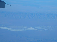
Cholame Valley (Parkfield's in there somewhere - just too small to see from that high up!):
Pinnacles National Monument (the exposed rock in the upper middle of the picture, with the city of Soledad in the foreground):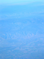
Loma Prieta (though I'm not entirely sure which of these peaks it is):
San Andreas in San Mateo (or possibly northern Santa Cruz) County (I think this is my favorite of the pictures):
I was definitely pretty giddy with excitement over the whole view by the time we landed at SFO. I suspect the way back to LAX will be just as awesome, if not more so, since I'll be flying in the middle of the day rather than at 6 PM. I managed to snag a window seat on the left side of the plane for that flight.
The first few minutes of the flight clung to the coast, but we swung back inland and caught up with the San Andreas Fault around the Big Bend. From there, we flew over...
The Carrizo Plain:

Cholame Valley (Parkfield's in there somewhere - just too small to see from that high up!):

Pinnacles National Monument (the exposed rock in the upper middle of the picture, with the city of Soledad in the foreground):

Loma Prieta (though I'm not entirely sure which of these peaks it is):

San Andreas in San Mateo (or possibly northern Santa Cruz) County (I think this is my favorite of the pictures):

I was definitely pretty giddy with excitement over the whole view by the time we landed at SFO. I suspect the way back to LAX will be just as awesome, if not more so, since I'll be flying in the middle of the day rather than at 6 PM. I managed to snag a window seat on the left side of the plane for that flight.
Monday, March 23, 2009
Geosong: Demolition Hammer's "Pyroclastic Annihilation"
In honor of last night's eruption of Mt. Redoubt - and its glorious timing with regards to someone called the governor of Louisiana's remark about volcanoes - I give you a death metal song about explosive volcanism.
Now, I'm not a death metal fan. It isn't even particularly on my listening radar, and tuneless screaming does not do much for me aesthetically. I do, however, think that if there is any situation in which this sort of musical treatment would be apt, the explosion of a mountain would be a good candidate. I also have to admit that I adore the title of this one. "Pyroclastic Annihilation," seriously, is a winner of a title.
My knowledge of the band that performs this song, Demolition Hammer, comes entirely from Wikipedia. They were a death/thrash metal band from the Bronx, active in the late 1980s and early 1990s. They disbanded around 1994 and are, from what I gather as an outsider to the genre, pretty obscure now.
The lyrics to "Pyroclastic Annihilation" have no sense of narrative or particular sentence structure of which to speak. It simply consists of various volcano-related terms and processes strung together in random order. The album this song comes from was produced in 1992, which was well before rampant Googling of things was prevalent, so I imagine the band must have trawled through some actual volcanology textbooks or articles to derive these lyrics. Most of the terms in there actually make sense, though there's a few that make me wonder what source they were actually looking at. Would anyone care to define "subrelluric forces" for me - a creative made-up definition definitely works, since I'm not finding anything real! Also, "intrusive tuff," guys? Yes, the random trawling for large and menacing phrases in a volcano book without any sense of meaning seems to have been the modus operandi here...
But still. A death metal song about explosive volcanism. For its flaws in lyrics, I still adore the concept. And it's actually screamed clearly enough that I can understand those lyrics without having to consult any external source. That's definitely worth something! And it also shows that even '90s death metal bands care about volcano monitoring.
Hear the song on YouTube (no video, though)
Lyrics
Oh crap, have I really not updated in almost a month? I had some really good excuses this month, at least, though they were stressful/depressing ones. It's spring break now. I have lots of things I actually want to write about, and will probably spew them out in the next few weeks.
Wednesday, February 25, 2009
...and then two more.
I was tempted, in light of specific sentences said by a particular politician yesterday, to forgo my planned Accretionary Wedge post and instead write about how every geologist, at some point in his or her life, should engage in a little volcano monitoring. I totally stand by my statement (and will be taking a class next quarter that absolutely involves volcano monitoring), but I also recall that we're collectively trying to come with 100 things, and there is certainly enough room in the budget of geological curiosity/exploration for me to write about those things in addition to snarking about things that other members of the geoblogosphere have already addressed so eloquently.
And now, the post I was planning to write before this madness went down.
The original 100 Places Meme lists the San Andreas Fault as a Must-See. I absolutely agree with this, but as I was marking the text on the list in bold, I got to thinking about how those three words mean a whole slew of very different places, spread out over hundreds of miles. The ultimate San Andreas experience is, of course, to drive the whole thing (or, well, the parts that are on land). I can't check off the full 800 miles yet, but I've been from the southern end of the Fault at the Salton Sea up through Point Reyes, mostly on roads that cling pretty close to the surface trace. I definitely recommend this drive as a means to check off the San Andreas on the original meme, but I also feel like there are several specific must-see sites along its trace (and within its system of associate faults) that deserve space on the expanded list.
The first place that came to mind, without me even having to really think about it, is Carrizo Plain National Monument, in rural San Luis Obispo County. The quintessential image of the San Andreas, the one that pops up in all sorts of textbooks and popular science books about earthquakes, the first photo that turns up when one does a google image search for the San Andreas, is from the Carrizo. It's an aerial photo of the Elkhorn Scarp, also known as the Dragon's Backbone, a 17-mile-long pressure ridge that, from above, looks like a gaping chasm into the depths of the Earth. (The original Superman movie actually does use the scarp as Supes' entry point into the fault...) It is a spectacular photo, but the view from the ground is equally breathtaking, and has the added bonus of debunking the faults-as-gaping-chasms myth.
The Carrizo Plain is one of the best places to see a wide variety of features associated with continental strike-slip faults. In addition to the outstanding pressure ridge, there is the famous Wallace Creek. This streambed crosses the San Andreas, but not without getting pulled around a bit first. Wallace Creek takes a sharp right angle turn as it meets the Fault, then parallels it for some 130 feet before heading back on its course. This shows the displacement power that the San Andreas has, and is all the more staggering when taking into account that some people think a good percentage of that displacement came from the 1857 earthquake alone. There are plenty of other offset streambeds that are less dramatic, as well as some channels that have been "beheaded" by the fault. The Carrizo also boasts more typical scarps, some spots of more trenchlike fault expression, stepovers with traceable surface expression, and a few (mostly dry) sag ponds.

If faults aren't really your thing, the Carrizo Plain is still worth a visit. The northernmost part of the Plain contains Soda Lake, a huge alkaline lake out of which many spectacular mineral samples (some of which are in the Visitor's Center, which is not open all the time) have been extracted from not very deep. The Carrizo is also thought to be an example of what the native Californian landscape might have looked like before the Europeans did anything to it - fields dominated by wildflowers and scrubby plants. For this reason, late March and early April are the best time to visit, since the wildflowers are out in full force, and the entire Plain is painted in shades of green, yellow, orange, and blue. (Don't go in the middle of the summer, though, unless you like triple digit temperatures.)
The next place I want to add to the list doesn't strictly feature the San Andreas; the town of Hollister's bisector is the Calaveras Fault, though the Calaveras branches off from the San Andreas just south of the town. The seat of San Benito County may lack scenes of breathtaking beauty that could make even a non-geologist drool, but it's also one of the best places to see the bizarre California-centric phenomenon known as aseismic creep. Creep is a phenomenon in which a fault moves slowly and steadily at around the tectonic loading rate, constantly releasing stress in a way that does not radiate seismic waves and generally prohibits enough buildup to cause a large quake (though some creeping faults may have asperities within the creeping zone that still accumulate stress and rupture seismically, even though creep continues around that zone). The main place (if not the only - I haven't heard of it elsewhere) this has been observed is in California, specifically on the Hayward, Calaveras, and Rogers Creek Faults in the Bay Area, the San Andreas between Parkfield and San Juan Bautista, and the Superstition Hills Fault near the Mexican border.
Creep can be measured with all sorts of complex instrumentation, but its easiest for the layperson to see when some sort of manmade structure gets put on the fault, and proceeds to get bent and deflected and cracked. The cities of Santa Rosa, Berkeley, Hayward, Fremont, and others all have the trademark offset curbs of a creeping fault, but I personally think that Hollister is the best city to look for offset because it looks like they've put less effort (or money) into patching up the distortion. Some sidewalks are bent several feet out of line, many streets are crossed by sets of en echelon cracks, and some houses and garages have obvious bulges in the walls and cracks in the foundation.

So Hollister is a good place to see creep as a phenomenon in and of itself, but it's also a clear exhibition of the interaction between the Earth itself and its inhabitants, of how people keep living in some places in spite of the geology. I suspect the fault was not known to be there when Hollister was first founded, which could explain some of the spectacularly bad locations of houses, but towns like this can be an example of how the hazards of the landscape should be taken into account when planning future development.
Not to mention that such intersections of humanity and seismicity make it clear that Fault Monitoring is also pretty darn important...
And now, the post I was planning to write before this madness went down.
The original 100 Places Meme lists the San Andreas Fault as a Must-See. I absolutely agree with this, but as I was marking the text on the list in bold, I got to thinking about how those three words mean a whole slew of very different places, spread out over hundreds of miles. The ultimate San Andreas experience is, of course, to drive the whole thing (or, well, the parts that are on land). I can't check off the full 800 miles yet, but I've been from the southern end of the Fault at the Salton Sea up through Point Reyes, mostly on roads that cling pretty close to the surface trace. I definitely recommend this drive as a means to check off the San Andreas on the original meme, but I also feel like there are several specific must-see sites along its trace (and within its system of associate faults) that deserve space on the expanded list.
The first place that came to mind, without me even having to really think about it, is Carrizo Plain National Monument, in rural San Luis Obispo County. The quintessential image of the San Andreas, the one that pops up in all sorts of textbooks and popular science books about earthquakes, the first photo that turns up when one does a google image search for the San Andreas, is from the Carrizo. It's an aerial photo of the Elkhorn Scarp, also known as the Dragon's Backbone, a 17-mile-long pressure ridge that, from above, looks like a gaping chasm into the depths of the Earth. (The original Superman movie actually does use the scarp as Supes' entry point into the fault...) It is a spectacular photo, but the view from the ground is equally breathtaking, and has the added bonus of debunking the faults-as-gaping-chasms myth.
The Carrizo Plain is one of the best places to see a wide variety of features associated with continental strike-slip faults. In addition to the outstanding pressure ridge, there is the famous Wallace Creek. This streambed crosses the San Andreas, but not without getting pulled around a bit first. Wallace Creek takes a sharp right angle turn as it meets the Fault, then parallels it for some 130 feet before heading back on its course. This shows the displacement power that the San Andreas has, and is all the more staggering when taking into account that some people think a good percentage of that displacement came from the 1857 earthquake alone. There are plenty of other offset streambeds that are less dramatic, as well as some channels that have been "beheaded" by the fault. The Carrizo also boasts more typical scarps, some spots of more trenchlike fault expression, stepovers with traceable surface expression, and a few (mostly dry) sag ponds.
If faults aren't really your thing, the Carrizo Plain is still worth a visit. The northernmost part of the Plain contains Soda Lake, a huge alkaline lake out of which many spectacular mineral samples (some of which are in the Visitor's Center, which is not open all the time) have been extracted from not very deep. The Carrizo is also thought to be an example of what the native Californian landscape might have looked like before the Europeans did anything to it - fields dominated by wildflowers and scrubby plants. For this reason, late March and early April are the best time to visit, since the wildflowers are out in full force, and the entire Plain is painted in shades of green, yellow, orange, and blue. (Don't go in the middle of the summer, though, unless you like triple digit temperatures.)
The next place I want to add to the list doesn't strictly feature the San Andreas; the town of Hollister's bisector is the Calaveras Fault, though the Calaveras branches off from the San Andreas just south of the town. The seat of San Benito County may lack scenes of breathtaking beauty that could make even a non-geologist drool, but it's also one of the best places to see the bizarre California-centric phenomenon known as aseismic creep. Creep is a phenomenon in which a fault moves slowly and steadily at around the tectonic loading rate, constantly releasing stress in a way that does not radiate seismic waves and generally prohibits enough buildup to cause a large quake (though some creeping faults may have asperities within the creeping zone that still accumulate stress and rupture seismically, even though creep continues around that zone). The main place (if not the only - I haven't heard of it elsewhere) this has been observed is in California, specifically on the Hayward, Calaveras, and Rogers Creek Faults in the Bay Area, the San Andreas between Parkfield and San Juan Bautista, and the Superstition Hills Fault near the Mexican border.
Creep can be measured with all sorts of complex instrumentation, but its easiest for the layperson to see when some sort of manmade structure gets put on the fault, and proceeds to get bent and deflected and cracked. The cities of Santa Rosa, Berkeley, Hayward, Fremont, and others all have the trademark offset curbs of a creeping fault, but I personally think that Hollister is the best city to look for offset because it looks like they've put less effort (or money) into patching up the distortion. Some sidewalks are bent several feet out of line, many streets are crossed by sets of en echelon cracks, and some houses and garages have obvious bulges in the walls and cracks in the foundation.
So Hollister is a good place to see creep as a phenomenon in and of itself, but it's also a clear exhibition of the interaction between the Earth itself and its inhabitants, of how people keep living in some places in spite of the geology. I suspect the fault was not known to be there when Hollister was first founded, which could explain some of the spectacularly bad locations of houses, but towns like this can be an example of how the hazards of the landscape should be taken into account when planning future development.
Not to mention that such intersections of humanity and seismicity make it clear that Fault Monitoring is also pretty darn important...
Monday, February 23, 2009
100 things...
So, since the upcoming Accretionary Wedge is about our personal addenda and recommendations for the Geologists' Life List, I figured I should do the actual original meme before writing up my entry. No matter how late on that bandwagon I may be...
The ones I've done/seen are in bold. Comments are in italic.
1. See an erupting volcano Not yet, but it seems very possible for April or May!
2. See a glacier
3. See an active geyser such as those in Yellowstone, New Zealand or the type locality of Iceland
4. Visit the Cretaceous/Tertiary (KT) Boundary. Possible locations include Gubbio, Italy, Stevns Klint, Denmark, the Red Deer River Valley near Drumheller, Alberta.
5. Observe (from a safe distance) a river whose discharge is above bankful stage
6. Explore a limestone cave. Try Carlsbad Caverns in New Mexico, Lehman Caves in Great Basin National Park, or the caves of Kentucky or TAG (Tennessee, Alabama, and Georgia) How about Luray Caverns, in Virginia?
7. Tour an open pit mine, such as those in Butte, Montana, Bingham Canyon, Utah, Summitville, Colorado, Globe or Morenci, Arizona, or Chuquicamata, Chile.
8. Explore a subsurface mine.
9. See an ophiolite, such as the ophiolite complex in Oman or the Troodos complex on the Island Cyprus (if on a budget, try the Coast Ranges or Klamath Mountains of California). There is no excuse for why I haven't seen one of these yet.
10. An anorthosite complex, such as those in Labrador, the Adirondacks, and Niger (there's some anorthosite in southern California too).
11. A slot canyon. Many of these amazing canyons are less than 3 feet wide and over 100 feet deep. They reside on the Colorado Plateau. Among the best are Antelope Canyon, Brimstone Canyon, Spooky Gulch and the Round Valley Draw.
12. Varves, whether you see the type section in Sweden or examples elsewhere.
13. An exfoliation dome, such as those in the Sierra Nevada.
14. A layered igneous intrusion, such as the Stillwater complex in Montana or the Skaergaard Complex in Eastern Greenland.
15. Coastlines along the leading and trailing edge of a tectonic plate.
16. A gingko tree, which is the lone survivor of an ancient group of softwoods that covered much of the Northern Hemisphere in the Mesozoic.
17. Living and fossilized stromatolites (Glacier National Park is a great place to see fossil stromatolites, while Shark Bay in Australia is the place to see living ones)
18. A field of glacial erratics
19. A caldera
20. A sand dune more than 200 feet high
21. A fjord
22. A recently formed fault scarp How recent is recent? I've seen one from 1971...Failed miserably at finding the Landers scarp, though.
23. A megabreccia
24. An actively accreting river delta
25. A natural bridge
26. A large sinkhole Apparently there is a sinkhole in the middle of the 215 freeway right now...
27. A glacial outwash plain
28. A sea stack
29. A house-sized glacial erratic
30. An underground lake or river
31. The continental divide
32. Fluorescent and phosphorescent minerals
33. Petrified trees
34. Lava tubes Another thing I will probably get to see in April or May!
35. The Grand Canyon. All the way down. And back. Saw it out the window of an airplane...
36. Meteor Crater, Arizona, also known as the Barringer Crater, to see an impact crater on a scale that is comprehensible
37. The Great Barrier Reef, northeastern Australia, to see the largest coral reef in the world.
38. The Bay of Fundy, New Brunswick and Nova Scotia, Canada, to see the highest tides in the world (up to 16m)
39. The Waterpocket Fold, Utah, to see well exposed folds on a massive scale.
40. The Banded Iron Formation, Michigan, to better appreciate the air you breathe.
41. The Snows of Kilimanjaro, Tanzania,
42. Lake Baikal, Siberia, to see the deepest lake in the world (1,620 m) with 20 percent of the Earth's fresh water.
43. Ayers Rock (known now by the Aboriginal name of Uluru), Australia. This inselberg of nearly vertical Precambrian strata is about 2.5 kilometers long and more than 350 meters high
44. Devil's Tower, northeastern Wyoming, to see a classic example of columnar jointing
45. The Alps. In Germany, Austria, and Italy. Though I went there for music-related reasons...
46. Telescope Peak, in Death Valley National Park. From this spectacular summit you can look down onto the floor of Death Valley - 11,330 feet below. There's also no excuse for why I haven't been to Death Valley yet, but that will probably be fixed this year.
47. The Li River, China, to see the fantastic tower karst that appears in much Chinese art
48. The Dalmation Coast of Croatia, to see the original Karst.
49. The Gorge of Bhagirathi, one of the sacred headwaters of the Ganges, in the Indian Himalayas, where the river flows from an ice tunnel beneath the Gangatori Glacier into a deep gorge.
50. The Goosenecks of the San Juan River, Utah, an impressive series of entrenched meanders.
51. Shiprock, New Mexico, to see a large volcanic neck
52. Land's End, Cornwall, Great Britain, for fractured granites that have feldspar crystals bigger than your fist.
53. Tierra del Fuego, Chile and Argentina, to see the Straights of Magellan and the southernmost tip of South America.
54. Mount St. Helens, Washington, to see the results of recent explosive volcanism.
55. The Giant's Causeway and the Antrim Plateau, Northern Ireland, to see polygonally fractured basaltic flows.
56. The Great Rift Valley in Africa.
57. The Matterhorn, along the Swiss/Italian border, to see the classic "horn".
58. The Carolina Bays, along the Carolinian and Georgian coastal plain
59. The Mima Mounds near Olympia, Washington
60. Siccar Point, Berwickshire, Scotland, where James Hutton (the "father" of modern geology) observed the classic unconformity
61. The moving rocks of Racetrack Playa in Death Valley
62. Yosemite Valley
63. Landscape Arch (or Delicate Arch) in Utah
64. The Burgess Shale in British Columbia
65. The Channeled Scablands of central Washington
66. Bryce Canyon
67. Grand Prismatic Spring at Yellowstone
68. Monument Valley
69. The San Andreas fault This could mean so many very different places!
70. The dinosaur footprints in La Rioja, Spain
71. The volcanic landscapes of the Canary Islands
72. The Pyrennees Mountains
73. The Lime Caves at Karamea on the West Coast of New Zealand
74. Denali (an orogeny in progress)
75. A catastrophic mass wasting event Does the Blackhawk Landslide in the Mojave count? Or does the question imply having actually witnessed the sliding?
76. The giant crossbeds visible at Zion National Park
77. The black sand beaches in Hawaii (or the green sand-olivine beaches) Again, might happen in April or May!
78. Barton Springs in Texas
79. Hells Canyon in Idaho
80. The Black Canyon of the Gunnison in Colorado
81. The Tunguska Impact site in Siberia
82. Feel an earthquake with a magnitude greater than 5.0. The M5.4 Chino Hills quake on 29 July 2008
83. Find dinosaur footprints in situ
84. Find a trilobite (or a dinosaur bone or any other fossil) I have olenellid trilobite heads from the Marble Mountains, Mojave Desert.
85. Find gold, however small the flake
86. Find a meteorite fragment
87. Experience a volcanic ashfall
88. Experience a sandstorm
89. See a tsunami
90. Witness a total solar eclipse
91. Witness a tornado firsthand. Part of me really wants to. Another part of me would probably collapse into a quivering ball of terrified.
92. Witness a meteor storm, a term used to describe a particularly intense (1000+ per minute) meteor shower
93. View Saturn and its moons through a respectable telescope. Also, Jupiter.
94. See the Aurora borealis, otherwise known as the northern lights.
95. View a great naked-eye comet, an opportunity which occurs only a few times per century Hyakutake in 1996 and Hale-Bopp in 1997.
96. See a lunar eclipse
97. View a distant galaxy through a large telescope
98. Experience a hurricane Does a tropical storm count? Been in several of those, but none were actually hurricanes when they got to where I was. Going out on the beach during a tropical storm is not really pleasant, even if it's interesting - getting pelted with sand at 60mph hurts!
99. See noctilucent clouds
100. See the green flash
That is not exactly the greatest showing ever. But I must remind myself that I've only been involved in geology in a non-popular-science-books-and-documentaries way for less than two years. I guess that's not so bad?
Saturday, February 21, 2009
Geology: Bringing Families Together
My younger brother is not much of a phone person. He actually isn't much of a continuous conversationalist in general, due to a combination of autism and a wide array of interests. In person, this makes him the King Of The Non-Sequitur, and a single conversation could contain traces of politics, football, recaps of favorite TV shows, NASCAR, video games, and whoever he's decided he thinks is hot. Sometimes these may all happen in a single paragraph.
He's just never really gotten the hang of the phone, though. A typical conversation with him consists of, "Hi, how are you?" And I'll respond, and he'll go, "Ok, bye!" He usually has to be prodded to talk to someone to begin with.
But this week, when I was on the phone with my parents, he specifically asked to talk to me. The reason for this? He's enrolled in Callan's intro geology course at Northern Virginia Community College, and clearly knew this would be something I'd be glad to discuss with him. (I think he's finally catching on that I don't care about NASCAR in the slightest.) To my utmost surprise, he talked with me about the topic of igneous rocks for fifteen minutes straight, with no changes of subject or express of unease about the phone itself. Fifteen whole minutes!
I was, of course, thrilled that he expressed such enthusiasm about the subject matter (and Callan, I'm sure you'll want to know that he got almost everything right when I quizzed him on things), but I think I was even more excited about the evolution of his conversation skills. It was really wonderful to talk with him for that long, especially since I only get to see him twice a year. Even though he didn't tell me directly how he's doing - he never does - I can tell he's getting along well and happily, based just on how vivid and prolonged that conversation on rocks was.
(And because I am so happy, I am going to embarrass him on the internet! Hah! Sibling duty! Even though I'm absolutely certain he doesn't read blogs. Love ya, M!)
Saturday, February 14, 2009
Volcanic Hazards for Humanities Majors
I have emerged from the depths of mid-quarter reading onto the island of Three-Day Weekend to make a post to my blog!
I taught my very first geology lecture on Tuesday. While I'm not technically a TA this quarter, I will be next quarter, and this lecture was for the same class. I ended up teaching this week because my adviser was out of town giving talks, and needed someone to cover for him. The class in question is one of those massive nonmajor earth science requirement courses - Natural Hazards. (Or, Ways The Earth Can Kill You, For Non-Majors.) This is normally a huge 500-person course, but the section this quarter is part of a special year-long course on California in general (first quarter was an English class on California novels, third quarter is on Native American history), geared at humanities majors in particular, and there are only 75 of them in the class. A slightly less formidable audience for a first big lecture!
This was not the first time I've ever taught; I was a TA for a year in the music department, but that was a much smaller class. My discussion sections had five students each, and they were supposed to sing for me. I have already found that it's much easier to impart information on a topic to a group of people than to make them practice a practical skill that they really really don't feel like doing. (It's especially hard when some of them can't even tell that the note they're singing isn't even in the same ballpark as the note I'm playing for them.)
Anyway, the lecture I got to give was about subduction zone and continental caldera volcanoes. This was very exciting to me, because volcanoes were my first geologic love, at age five or six. When you're that little, books about volcanoes tend to also be about earthquakes, so I quickly developed an interest in those as well, but the volcanoes did come first. My adviser's previous lecture had been about Hawaii and Iceland, so I got to jump right in with the really big booms. It necessarily had to be a pretty simple lecture in terms of explanatory science (the textbook states everything in terms of The Three Vs Of Volcanism: Volume, Volatiles, and Viscosity); I was supposed to cover the phenomenology of big bad eruptions more than anything else. I spent a good long time on pyroclastic flows and lahars, with historical examples from all over the world, then went into more depth on sequence of a stratovolcano eruption by describing (of course) Mt. St. Helens. (I also mentioned that Mt. Redoubt is a stratovolcano with imminent eruption, though not on that sort of scale, and I was surprised that nobody seemed to have heard of it!) I ended by tying these rest-of-the-world examples in with specific California sites (ski Mammoth before it blows, guys!), and by showing video of the Salton Sea Mud Volcanoes, because they're awesome.
I really tried to impart the impression that, "These volcanoes are fascinating, beautiful, and can totally kill you," and I really hope that more than just the two talkative students came out of the lecture sharing my enthusiasm and trepidation over all things volcanic. As I expected, based on the undergrad level classes I've taken here, the class was pretty quiet and stonefaced throughout, and they seemed loath to actually answer the questions I asked, even though it was stuff they totally should have known from the previous Thursday's lecture, if nothing else. I hope that their lack of response was just because I was the new unfamiliar guy, and have no actual grade-giving power. Because seriously, how could anyone not find extremely explosive volcanoes even a little bit cool?
Despite the unresponsiveness, I enjoyed giving this lecture, and it was definitely valuable practice for future TAing and lecturing in years to come. I'm looking forward to properly TAing this class next quarter, even though I know to expect some degree of apathy from people who are mostly just filling gen-ed requirements. I'm hoping I'll be able to indoctrinate at least a few of them into enthusiastic geogeekery!
Saturday, January 17, 2009
Northridge At Fifteen
I don't actually remember Northridge. I was nine years old at the time, but I also happened to be living just outside of Washington DC at the time. January of 1994 was memorable, but mostly because it was single digit temperatures, the furnace broke in our house, and so much ice fell out of the sky that my friends and I literally ice skated on the front lawn on Super Bowl Sunday. I'm sure I did hear about the earthquake in Los Angeles at some point, but I don't actually remember it.
It seems like there isn't a whole lot of remembering going on in the media today, either. The LA Times website has a photo gallery, but it's not a top-story link, and it wasn't in the print edition. They did run a short story about building codes, specifically about how soft first story buildings are bad, but the article was rather impersonal to my mind. Cal State Northridge's website mentions nothing. Papers more local to me (which are, admittedly, not super close to Northridge) mention nothing. This strikes me as weird, because I know so many people who have Northridge stories. Granted, they don't just volunteer them; the stories tend to come out when I mention the quake specifically (as I often do, as an example of why blind thrust faults are very scary), or when I mention that I've never personally felt ground motion strong enough to scare me. Once the topic is breached, they seem glad to tell me where they were, exactly what they were doing, how it all felt. Their stories are generally quite detailed, particularly considering most of my friends were also pretty little at the time.
And yet, despite the details, it takes pulling to get those stories out. I'm wondering if that comes from the larger culture of the region, the whole image Southern California as sun-drenched carefree paradise and home to the stars. What could possibly go wrong here? We don't have wildfires! We don't have earthquakes! Because if we let anyone know that we do, nobody will come here anymore. For these reasons, I really shouldn't have been surprised that media coverage of the anniversary has been unimpressive. The annual ceremony at Lotta's Fountain this most certainly is not.
I think the stories need to stay out there. They should be collected and available. They shouldn't be allowed to leave the public consciousness. Sure, they may reside in the minds of people who were here, but to everyone who has moved out here in the past fifteen years, what about them? As a relative newcomer to the West Coast myself, I wouldn't have heard the personal details unless, as I said, I started the conversation about them. The information needs to be out there, not to scare people, but to keep them informed and safer. Stories about, say, 1906 might be ample and fascinating, but that's a different city and a different age and a much bigger earthquake. The Los Angeles of 1994 was not that drastically different from now, and Northridge therefore shows the effect of a quake on a modern city. Not to mention that it shows that you don't need The Big One in order to still be Big Enough. How can anyone prepare if they're only hearing the scientific side of what we're in for, rather than the personal side as well?
Last week, after the 4.5, the LA Times ran a short article about how 2008 had more moderate-sized quakes than 2007, and how it was the most seismically active year since 1999 (which included the 7.1 Hector Mine quake and its aftershock sequence). My immediate wonder was if this means that any stress shadows left behind by Landers, Hector Mine, and Northridge are starting to dissipate. It is, of course, far too early to say if this will be a continuing trend, and no seismologist who cares about his or her reputation is going to use those figures to predict anything. But let's say, for argument's sake, that seismicity continues to be higher in the next few years. Shouldn't we be trying to pull people's awareness out of that post-Northridge stress shadow as well?
Thursday, January 8, 2009
4.5 in the Inland Empire
There was a magnitude 4.5 earthquake in San Bernardino tonight, with a depth of 8 miles and a fault plane solution that suggests strike-slip, but not the San Jacinto or the San Andreas.
I would have liked to have live-blogged this from the epicentral region, but my iPod didn't want to pick up the coffeeshop's internet, so I had to drive home. But when I say "epicentral region," I mean it. I was about four and a half miles from the epicenter when the quake it. I've been closer to them before, but those were all much smaller - as in, 2.6. 4.5 was a whole different kind of experience this close.
I was at a coffeeshop in Redlands with some friends; we were all sitting at a table outside. I felt a little wiggle, and apparently so did a few of the others, since someone said, "Hey, is that an earthquake?" There was time for some confused looks before the shaking got stronger, and the general response was, "Oh yeah, earthquake!" It then proceeded to get even stronger for a little bit, before fading. I'd say that, on the whole, it could have been up to fifteen seconds of shaking. The thing that really excited me, though, was feeling three wave arrivals. I know I felt S and Surface for Chino Hills in July, but I wouldn't have felt P in a car with good shocks. Sitting outside, though, there's no such damping. There were definitely three different jolts, each stronger than the last. This one was a really good ride, and it made my day.
I'm also really curious to see how well QCN did in terms of picking this one up, since many more people are running the software than there were for Chino Hills. I know that my laptop picked up a good waveform for that one, and I'm hoping it did for this one as well, since the computer was by itself and not being used at the time of the quake. There isn't a way for me to scroll back that far through my computer's own records to see if I picked it up, so I'm guessing I won't know until tomorrow, at least, providing that those of us who picked up the signal get an email about it, like last time. I'll post on here about it if I do find out.
There was also a magnitude 3.3 aftershock about an hour after the mainshock, but I didn't feel it because I was in the car. I think I was actually going over the dreaded 10-215 interchange (which goes directly over the San Jacinto Fault) at the time, so it's really good that I didn't feel it. I admit that, every time I go over that interchange, I think, "Not now, San Jacinto, not now!" Feeling a shake on that overpass would probably break my brain.
Subscribe to:
Posts (Atom)